|
|
|
Travel Index |
|
|
|
|
 Western U.P. Waterfalls
|
 |
Porcupine Mountains Presque Isle Park
Presque Isle Waterfalls Photos
The Falls
The FallsMap
(Click here or on map for large view & directions)
Caution: The falls and Rapids of the Presque Isle River have very strong currents and numerous deep holes. Please respect the power and hidden dangers of this turbulent and beautiful river. The park includes a picnic, camping, and parking area. There are numerous other waterfalls within the Porcupine Mountains State Parks interior. For more information on these waterfalls you can reach the park office at 906-885- 5275
Directions: Just outside of Wakefield on Hwy M28 take Cty Rd 519 North up a incline. Follow that road! When you come to South Boundary Rd keep going straight (This will lead you to the park). Please take your time and enjoy the view. This road is approximately 22 miles long.
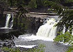
Manabezho Falls - This is a very wide beautiful waterfall with an extremely large drop. Easily - accessible and very few steps.
Manido Falls - This waterfall is a short additional walk from Manabezho Falls. It is smaller than Manabezho Falls, but proves to be just as wide and photogenic.
Nawadaha Falls - This Waterfall is an additional short walk from Manido Falls. The rapid current will be sure to grab your attention.
Waterfalls of the Western U.P. Main Page
Black River | Hidden Secrets | Off The Beaten Path


